
Menu
Menu
Menu
Verified Views (AVRs) for Planning Applications
Survey-verified photomontages that show what a proposal will actually look like in its setting. I produce verified views for planning applications, TVIAs and LVIAs, heritage assessments and public inquiries. I’m based in Leicester and work across the Midlands and the UK
What is a verified view?
An Accurate Visual Representation (AVR) combines photography of the existing site with a precise render of the proposed development. Each view comes from a surveyed camera position and recorded camera geometry, so it’s a measurable representation of the scheme, not an artist’s impression.
You may also hear them called Visually Verified Montages (VVMs), verified photomontages or certified views. The terminology varies, but the method is the same.
Which level do you need?
Views are produced to one of four levels in the Landscape Institute’s TGN 06/19. The local planning authority often sets the level and the viewpoints, so it’s worth confirming early. Specifying too low a level can mean redoing the work.
Level 00: location and size of the proposal, shown as an outline on the photograph (a photowire).
Level 01: adds the degree of visibility, shown as massing, so you can see what can and can’t be seen.
Level 02: adds architectural form, such as windows, doors and floors.
Level 03: adds materials. A fully rendered, photorealistic photomontage.
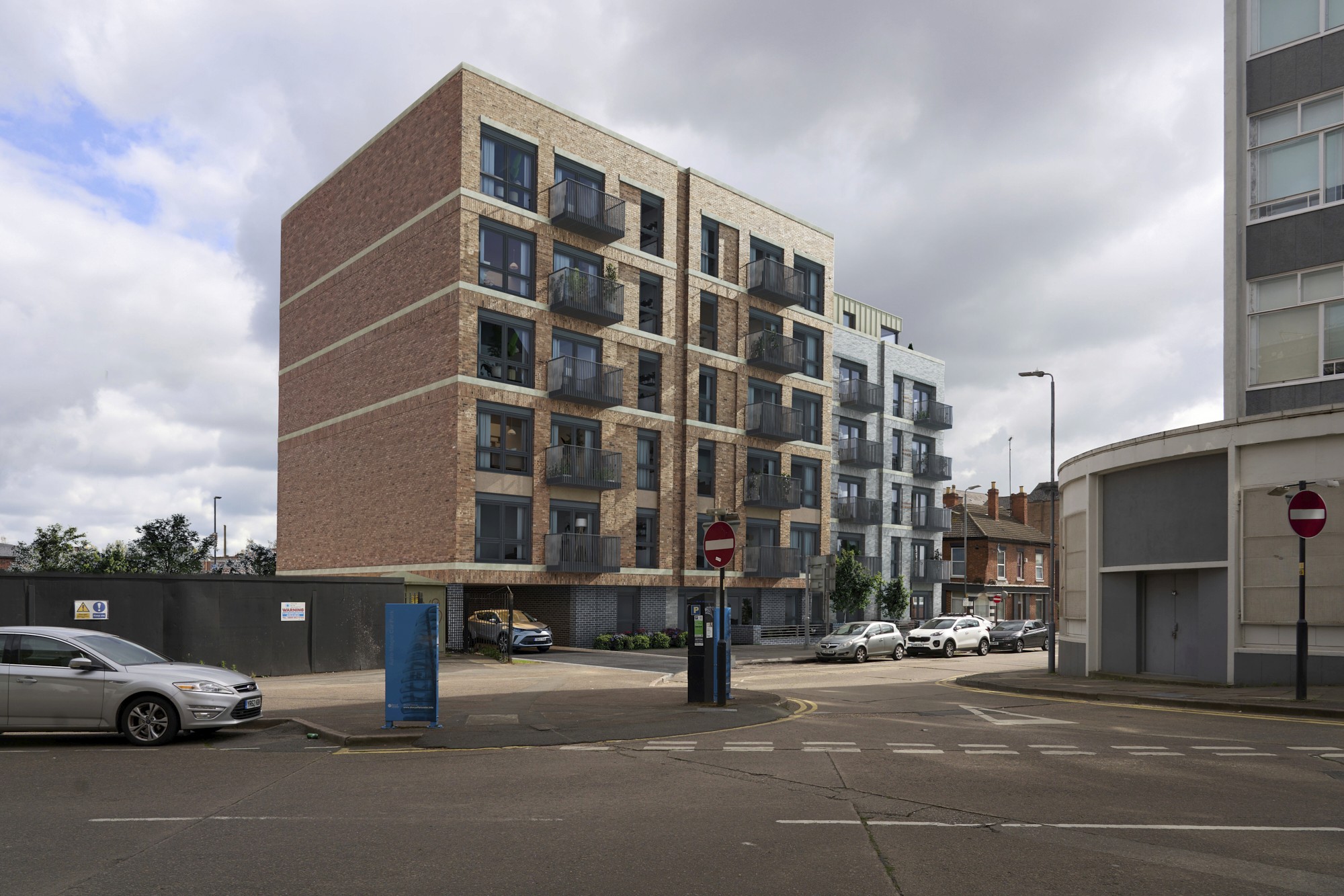
On Bruce Street, Leicester City Council chose the viewpoints and asked for Level 03 imagery for a residential scheme attached to a listed building.
How it works
Brief and viewpoints. We agree the views with you and, where relevant, the planning authority or your LVIA consultant.
Site survey. Viewpoints are fixed by GPS and total station survey with our surveying partner, Castle Surveys. Photography is taken under controlled conditions, with date, time and weather recorded.
Model and camera match. Your scheme is matched to the photograph using the recorded camera geometry.
Render and composite. Lighting, materials and context are built to the level required.
Delivery. Final views are supplied with a methodology statement written to the standard needed for submission with a planning application, TVIA or LVIA.
Standards I work to
Landscape Institute, Guidelines for Landscape and Visual Impact Assessment (3rd edition).
Landscape Institute, Technical Guidance Note 06/19: Visual Representation of Development Proposals.
London View Management Framework (Revised SPG).
What I need from you
Site location and red line boundary
The 3D model, or CAD plans and elevations of the proposal.
Materials & any relevant landscape details.
Viewpoint list from the planning authority (or let me know if it’s still to be agreed).
Required level, if known.
Your submission deadline.
Selected Projects
Recent verified views


Selected Projects
Recent verified views
Selected Projects
Recent verified views
Contact
Want to start a project or just say hello? You can reach us at any of the contact details below.
Phone
Copied!
Copied!
Contact
Want to start a project or just say hello? You can reach us at any of the contact details below.
Phone
Copied!
Copied!
Contact
Want to start a project or just say hello? You can reach us at any of the contact details below.
Phone
Copied!
Copied!
Based at;
Leicestershire studio working across the Midlands and UK.
Monday to Friday:
08:30 to 17:00
Based at;
Leicestershire studio working across the Midlands and UK.
Monday to Friday:
08:30 to 17:00
Based at;
Leicestershire studio working across the Midlands and UK.
Monday to Friday:
08:30 to 17:00